Activity 1: How Large are the Oceans? (Make a Model)
~Required
Do you know how large the earth's oceans are? How much area do they cover? In this activity you will explore this question. Start by sizing up the world map below. Predict the size of the continents and number them from 1-7 in order of largest to smallest. Record this in your science journals. Answer these questions:
- Which is the largest continent?
- Which is the smallest?
- Is the ocean larger or smaller than the area of the continents combined?
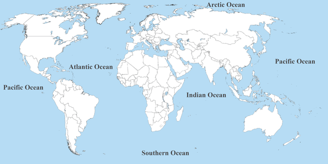
Now study the map below. Record in your science journal the differences between the two maps. Geographers do not all agree on the number of oceans. Use the link below to gather information. Answer in your science journals:
Link: NOAA website
http://oceanservice.noaa.gov/facts/howmanyoceans.html
- Which oceans have historically been recognized?
- How many are recognized today? Which is the "new" ocean?
- Is there a majority consensus on the number of oceans recognized today?
Link: NOAA website
http://oceanservice.noaa.gov/facts/howmanyoceans.html

You will now make a model of the ocean and continents to compare their actual sizes.
materials: ruler, 4-5 sheets of 9x11 paper
activity source: Disneynature teacher guide.
http://cdn.dolimg.com/disneynature/chimpanzee/downloads/oceans/Disneynature_OCEANS_Educators_Guide_42-Page_FINAL.pdf
materials: ruler, 4-5 sheets of 9x11 paper
- Use a sheet of paper and a ruler to cut a square measuring 8" by 8'" and color the sheet blue. This sheet of paper is a square that represents a scale model of the ocean. The world ocean covers about 134,000,000 square miles. The scale is about 1 square inch for every 2 million square miles.
- Use the remaining 9x11 computer paper to cut out the squares listed in the chart that represent the area each continent covers.
- Write the names of the continents on the squares
- Arrange the squares in order from largest to smallest. Are you surprised by what you found? Did you predict correctly at the beginning? Record the results in your science journals.
- Now place the squares on the large square that represents the area of the oceans. Which is larger, the world ocean or all of the continents combined?
- Estimate how much larger the world ocean is than the continents.The combined area of the continents is 57,000,000 square miles and the area covered by the oceans is 134,000,000 square miles. Show all work in your science journals.
activity source: Disneynature teacher guide.
http://cdn.dolimg.com/disneynature/chimpanzee/downloads/oceans/Disneynature_OCEANS_Educators_Guide_42-Page_FINAL.pdf
Activity 2: Ocean Waves~ Build a Jetty (Make a model)
~Required
Ocean waves carry energy across the globe, affect the ocean creatures, organisms, and shape and alter the shorelines. You may ask yourself these questions when investigating ocean waves. Waves are easy to see and hear, but they do not function alone. Waves are a flow in the ocean, causing interaction between land, the atmosphere, and organisms.
You will explore these questions in this activity and in the readings. Highlight the question that you are the most curious about and write it in your science journal.
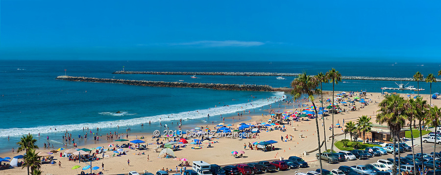
Now you will Construct a jetty. A jetty is a structure, that can be made from a variety of materials (most commonly rock), that blocks a current. A jetty stands in the way of a current, blocking its path to a shore. These structures are man-made and serve a variety of purposes. Look at the picture of a jetty below. Record in your science journal your predictions:
~Required
Ocean waves carry energy across the globe, affect the ocean creatures, organisms, and shape and alter the shorelines. You may ask yourself these questions when investigating ocean waves. Waves are easy to see and hear, but they do not function alone. Waves are a flow in the ocean, causing interaction between land, the atmosphere, and organisms.
- What causes ocean waves?
- How are they formed?
- Why are they important?
You will explore these questions in this activity and in the readings. Highlight the question that you are the most curious about and write it in your science journal.
Now you will Construct a jetty. A jetty is a structure, that can be made from a variety of materials (most commonly rock), that blocks a current. A jetty stands in the way of a current, blocking its path to a shore. These structures are man-made and serve a variety of purposes. Look at the picture of a jetty below. Record in your science journal your predictions:
- How do ocean waves affect the shoreline?
- What purpose does a jetty serve?
- Where would it be useful to build a jetty?
Now, working with a team of 3-4 people, together construct a Jetty to test out your ideas and to observe wave movement.
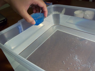
Materials: Clear Plastic tub, sand, ruler, rocks and pebbles, wooden craft sticks, interlocking plastic blocks, water, index card
Follow the steps below:
Both waves and currents can affect a beach and may occur depending on the wind direction.
Make Observations
Record your observations in your science journals. Go back and answer the questions from the beginning of the activity.
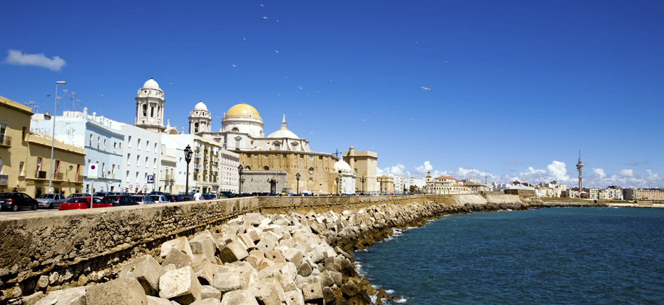
Look at the photo below of the port city of Cadiz, Spain. From the picture, how is the city built to protect the land against the ocean waves?
Materials: Clear Plastic tub, sand, ruler, rocks and pebbles, wooden craft sticks, interlocking plastic blocks, water, index card
Follow the steps below:
- Fill the bottom of the tub 4 cm deep with sand
- Dampen the sand with water, so that it sticks to itself
- layer the sand toward one side of the tub so it slopes downward like a beach
- Slowly pour water until half the beach is under water and half is above
- use rocks, craft sticks, and/or blocks to build a jetty off the beach
- model waves by using an index card to create waves from one end of the tub
- model currents by moving the tub around in circles create a current in the water
Both waves and currents can affect a beach and may occur depending on the wind direction.
Make Observations
- How does the jetty affect the movement of the sand when you make the water move?
- Create an inlet to the model beach by digging out a trench with you fingers
- Try the investigation over again with moving the jetty to different locations.
Record your observations in your science journals. Go back and answer the questions from the beginning of the activity.
Look at the photo below of the port city of Cadiz, Spain. From the picture, how is the city built to protect the land against the ocean waves?
Now visit the following Link below and read about Jetties. Write a 2-3 paragraph summary in your science journals about the purposes, types, and uses of jetties. How do jetties interact with the ocean waves to protect the land? Record at least 3-4 facts.
http://education.nationalgeographic.com/education/encyclopedia/jetty/?ar_a=1
http://en.wikipedia.org/wiki/Jetty
http://education.nationalgeographic.com/education/encyclopedia/jetty/?ar_a=1
http://en.wikipedia.org/wiki/Jetty
Now to see how a jetty works, check out this video!
A Jetty can also be a natural super soaker! Watch out for rough seas....On a very windy or stormy day you don't want to be out on a jetty or else you may end up a little wet!
Activity 3: Ocean Currents. The mighty forces! What Causes Ocean Currents? (Perform an Experiment)
One of the most fascinating and powerful elements of the ocean are the currents that drive the movement of water under the surface. While surface waves are visible from a ship or the beach, the currents move water under the surface. They are powered by wind, the coriolis effect, and density currents. Without these powerful currents and a knowledge of how they work, ocean travel would be difficult and dangerous. To get started watch this clip from the Disney-Pixar movie "Finding Nemo". Are you ready to jump on the ride to learn more about currents?
One of the most fascinating and powerful elements of the ocean are the currents that drive the movement of water under the surface. While surface waves are visible from a ship or the beach, the currents move water under the surface. They are powered by wind, the coriolis effect, and density currents. Without these powerful currents and a knowledge of how they work, ocean travel would be difficult and dangerous. To get started watch this clip from the Disney-Pixar movie "Finding Nemo". Are you ready to jump on the ride to learn more about currents?
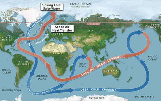
In the movie clip Crush tells Marlin that he is riding the EAC. What is the EAC? This is the acronym for the East Australian Current. The East Australian Current is just one of the many surface currents that drive the mass movement, or flow, of ocean water. Together these currents form the great Ocean Conveyor Belt that slowly moves water all around the globe in a pattern. All of the Oceans together form one global ocean!! The currents circulate among this global ocean, causing the world ocean to be connected.
Start with questions:
Write down these 3 questions in your science journals. You will answer these questions through the activity and readings.
Now look at the picture of the world below. Discuss with your team members this question:
Now click on the map below to find out. Study the new map and labels. What does the new map show that the arrows stand for?
Start with questions:
Write down these 3 questions in your science journals. You will answer these questions through the activity and readings.
- What are ocean currents?
- What causes ocean currents?
- More warm currents flow near the equator, and more cool currents flow near the poles. Why is this so?
Now look at the picture of the world below. Discuss with your team members this question:
- What do you think the arrows stand for?
Now click on the map below to find out. Study the new map and labels. What does the new map show that the arrows stand for?
Ocean Currents are composed of surface currents and Density currents. Think about the word dense. What does it mean if something is "dense"? A dense item is something that is closely compacted and this can make it heavy. Imagine that you are holding a basketball and bowling ball of the same size. Which one is more dense? Which one is heavier? Ocean water follows the same rules. Ocean water can be more dense or less dense and this depends on a number of factors that include temperature and salinity (which is the amount of salt in the water). Which do you think is more dense, surface currents or density currents? (yes this is an obvious question...hint hint! ;) But why are these currents different in density? You will soon find this out!
Now we will make a model as a team to learn what causes the different density and currents. How do they work? As a team, choose a place at one of the tables in the back to work. You will need the materials listed below.
Go with the Flow! Perform an Experiment:
Materials: a plastic bowl or container, blue dyed iced cubes, aquarium, red food coloring, globe, glass baking dish
Purpose:
Look at the globe. All of the oceans on earth are really one giant "super ocean". The water from all the oceans mixes together and moves around the earth. We will see how this happens.


|
Procedure:
|
The activity showed you how ocean water moves around the earth through currents created by change in temperature and salinity (density caused by salt. more salt causes greater density).
Why do you think water on the surface of the ocean is warmer than deep down?
How do you think currents affect fish? Ships? Swimmers?
Why do you think water on the surface of the ocean is warmer than deep down?
How do you think currents affect fish? Ships? Swimmers?

Read pages 104-109
Now to learn more about currents read pages 104-109 in the textbook above. You will find the textbook in our class library. Answer the 3 questions from the beginning of the activity in your science journals as you read.
Activity 4: Marine Habitats (Be a Marine Biologist. Make an Ocean Adaptation Wheel)
Have you ever wondered what kinds of marine organisms live where in the ocean?!! Maybe you've been snorkeling and have seen different sea creatures, corrals, anemones, and crustaceans on the reefs. Just what causes certain seas creatures to live where? As you will soon find out, just as animals on land have specific habitats where they can survive and live, so do animals in the sea!
Have you ever wondered what kinds of marine organisms live where in the ocean?!! Maybe you've been snorkeling and have seen different sea creatures, corrals, anemones, and crustaceans on the reefs. Just what causes certain seas creatures to live where? As you will soon find out, just as animals on land have specific habitats where they can survive and live, so do animals in the sea!
While people have been exploring the land and water for centuries an amazing fact about the oceans remains...according to the NOAA we have only explored about 5% of the oceans! That means that there is still 95% still to be discovered! Still people are constantly exploring the ocean, whether for recreation or research! Look at the pictures and read the captions below of ways that people explore marine habitats.
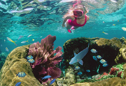
Snorkeling
Many people enjoy viewing shallow water corral reefs while snorkeling. Through this method, a swimmer uses a tube that sticks out of the water to breath.
Many people enjoy viewing shallow water corral reefs while snorkeling. Through this method, a swimmer uses a tube that sticks out of the water to breath.
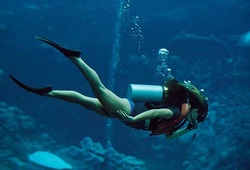
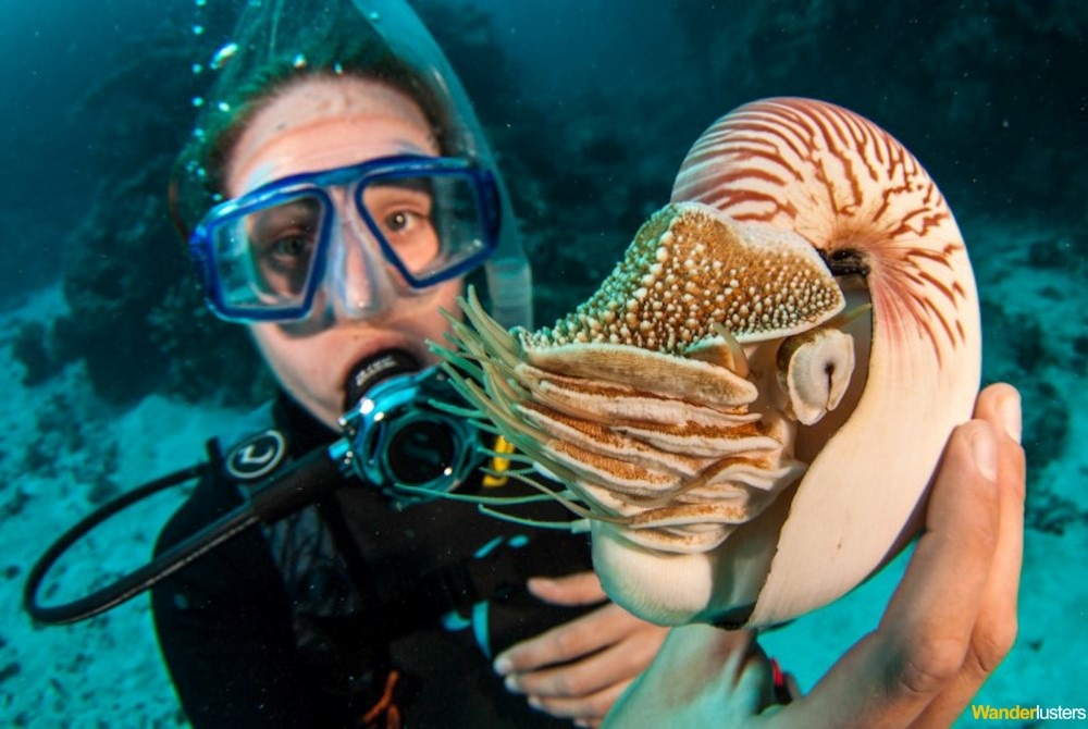
Scuba Diving
Deeper marine habitats can be observed by scuba diving. Scuba divers can explore underwater up to 50 meters with the use of the self contained underwater breathing apparatus (scuba). The normal diving range is between 30-40 meters. Scuba diving allows people to see a whole different set of marine organisms up close that you can't observe by shallow water snorkeling!
Deeper marine habitats can be observed by scuba diving. Scuba divers can explore underwater up to 50 meters with the use of the self contained underwater breathing apparatus (scuba). The normal diving range is between 30-40 meters. Scuba diving allows people to see a whole different set of marine organisms up close that you can't observe by shallow water snorkeling!
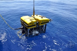
Research Vessels and ROVs
Finally to explore the ocean depths, exploration vessels such as the "Nautilus Live" will use remotely operated vehicles (ROVs). These robotic machines allow researchers to collect marine samples, take photographs and videos, and to explore deep areas of the ocean where humans aren't able to go. To learn more check out this link:
http://www.nautiluslive.org/vehicles/hercules
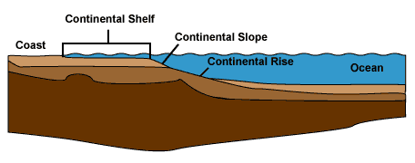
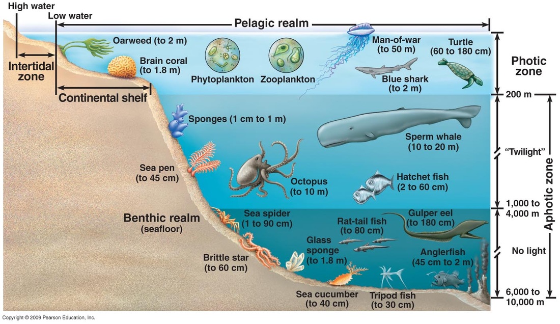
Three key factors affecting where marine organisms can live are sunlight, temperature, and the salinity or saltiness of the water. While there are still other factors, we will focus on these three. Marine habitats can be separated into costal and open ocean habitats.Costal habitats are located in the area from where the tide comes in on the beach out to the edge of the continental shelf. The continental shelf is the extended area surrounding a continent that acts as a plain before sloping steeply into the open ocean. See the picture below.
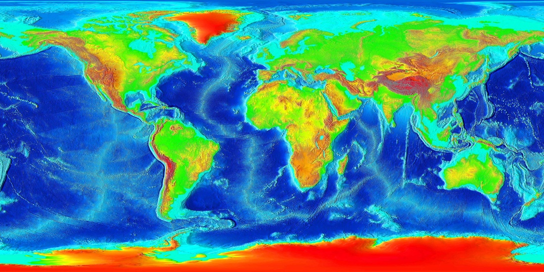
The image below is a topographic map of the world showing the land and undersea elevation. The light blue color surrounding the continents is the continental shelf. Darker blue areas show deeper waters.
Marine habitats are divided into layers or zones depending upon the amount of sunlight each receives. As depth increases the amount of light decreases. The sunlight zone is from the surface of the ocean to 600' and receives the most sunlight. The twilight zone is from 600' to 3000' and receives little light. The midnight zone is 3000' to about 15,000' and the only light here is produced by bioluminescence (which is when an organism or animal gives off its own light). See the photo below!
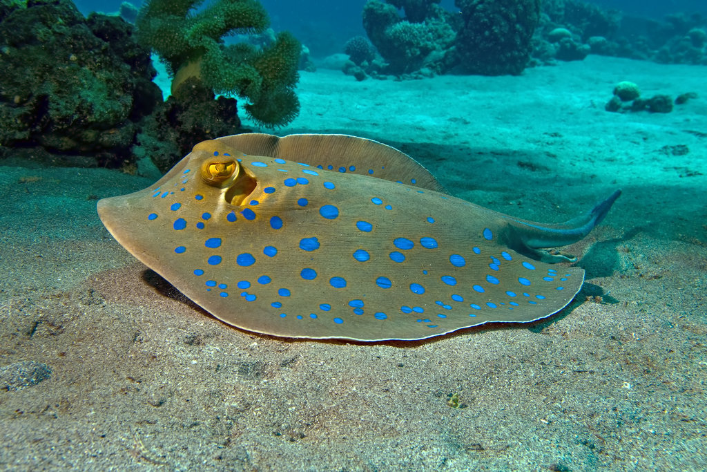
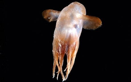
In what ocean zone would you find the Sea Creatures pictured below???? Guess and click on the buttons to see if you are correct!
Now that you know what causes different marine habitats you will begin the activity! You will select a fish or marine animal and take on the role of a marine biologist to discover the animal's adaptations to available light and other environmental factors. An adaptation is trait that an animal has that allows it to live in a certain area.
Materials: 2 paper plates, a brad, pencil, ruler, colored markers or pencils for decorating
Ocean Adaptation wheel
You will need the materials above for the activity. Come see me for the materials! Use the pencil and ruler to divide each plate into four equal sections. Cut out one section of one plate (1/4 of the plate) and use the brad to connect the plates in the center with the cut out plate on top. The top plate is to be illustrated with a drawing of the fish or mammal in its natural habitat. Label the bottom sections Prey, Predators, Adaptations (special body features) and Habitat Zone. I you would like, you may draw these and add a brief description, or yo may simply write and provide the data.
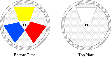
Your plate will look similar to this but with 4 cut out sections instead of 3! :)
Ocean Food Chain
Discuss with your team to each choose a different marine animal or organism. After completing your wheels you will join with your team and create a display showing the ocean food web by connecting your plates with yarn. As a team you will research the ocean food chain and determine where each creature should go in the chain. Together write a 1-2 paragraph explanation of the food web and as a team present your findings to me! (Use the information in the Predator/Prey sections of the wheels for this. You may wish to include humans in the food web and discuss aquaculture)
Use the following Resources below to research your marine animal/organism.
Secrets of the Ocean Realm
http://www.pbs.org/oceanrealm/
Nature: "Humpback Whales"
http://www.pbs.org/wnet/nature/humpback/
Nature: "Incredible Suckers"
http://www.pbs.org/nature/suckers
Nature: "The Octopus Show"
http://www.pbs.org/nature/octopus/
Nature: "The Secret World of Sharks and Rays"
http://www.pbs.org/nature/sharks/
Nature: "Sperm Whales: The Real Moby Dick"
http://www.pbs.org/nature/spermwhales/
Seafood Choices
http://www.seafoodchoices.org/
Activity 5: Climate Change and the Ocean. Why should I Care?!! (Perform an experiment)
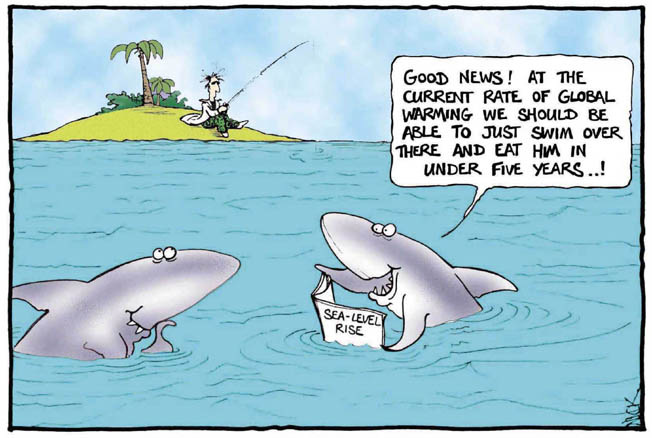
You have probably heard many people talk about global warming and climate change. Maybe you have heard people say things like, "the ice is melting and the polar bears are all going extinct!!" "the air is getting filled with harmful gases", "we need to Reduce, Reuse, Recycle to stop global warming". There are many mixed messages going around as to what global warming means, how it is affecting our earth, and how it affects your life! The question that you will answer in this activity is; how does global warming affect the oceans?
To get started work with your team to create a global warming wordle. Go to the wordle website link below. Click on the "Create" tab at the top of the page. As a team, brainstorm and enter in as many words as you can think of that have to do with global warming. Remember entering the same word more than once will make it appear larger in the wordle (so enter words that are most important multiple times). Print off a copy of your wordle for each member of your group and glue them in your science journals. Write a paragraph in your journals explaining how you think the oceans are affected by climate change. Use at least 2-3 words from your wordle in your paragraph.
http://www.wordle.net
Now you will perform an experiment with your group to see how the Oceans are being affected by climate change. Follow the link below to an activity from the NOAA, the National Oceanic and Atmospheric Association. This site is funded by the U.S. Department of Congress and as a governmental agency is a reliable source of information on global climate change. When looking for information on global climate change it is important to look for reliable sources to make sure that the information that we are learning is accurate. Talk about these questions with your team. Define a "reliable source" and give examples in your science journals.
Now visit the site and read the introduction of the lesson. When you get to the "how to do it" section stop and come see me for materials. This lab has many steps, and it is very important that you read the directions carefully! I will give you the listed materials. Make sure to wear your safety goggles! After completing the lab, record all observations and how long you had to breath on the solution to alter the color.
http://oceanservice.noaa.gov/education/discoverclimate/NOAA_Activity%207_Why-Should-I-Care.pdf
Take the time to look at the images of the pteropod shell that dissolves in the acidic ocean water.
http://www.pmel.noaa.gov/co2/story/What+is+Ocean+Acidification%3F
To get started work with your team to create a global warming wordle. Go to the wordle website link below. Click on the "Create" tab at the top of the page. As a team, brainstorm and enter in as many words as you can think of that have to do with global warming. Remember entering the same word more than once will make it appear larger in the wordle (so enter words that are most important multiple times). Print off a copy of your wordle for each member of your group and glue them in your science journals. Write a paragraph in your journals explaining how you think the oceans are affected by climate change. Use at least 2-3 words from your wordle in your paragraph.
http://www.wordle.net
Now you will perform an experiment with your group to see how the Oceans are being affected by climate change. Follow the link below to an activity from the NOAA, the National Oceanic and Atmospheric Association. This site is funded by the U.S. Department of Congress and as a governmental agency is a reliable source of information on global climate change. When looking for information on global climate change it is important to look for reliable sources to make sure that the information that we are learning is accurate. Talk about these questions with your team. Define a "reliable source" and give examples in your science journals.
- What does reliable mean?
- What makes a source reliable?
Now visit the site and read the introduction of the lesson. When you get to the "how to do it" section stop and come see me for materials. This lab has many steps, and it is very important that you read the directions carefully! I will give you the listed materials. Make sure to wear your safety goggles! After completing the lab, record all observations and how long you had to breath on the solution to alter the color.
http://oceanservice.noaa.gov/education/discoverclimate/NOAA_Activity%207_Why-Should-I-Care.pdf
Take the time to look at the images of the pteropod shell that dissolves in the acidic ocean water.
http://www.pmel.noaa.gov/co2/story/What+is+Ocean+Acidification%3F
Activity 6:The Turning Tides
(Act it out! Group activity)
If you've ever been to the Ocean long enough you may have noticed a curious phenomenon. You may have been out on the beach early in the day playing and then took a break and went inside for lunch. If you decided to come back out again in the evening you would have noticed a curious thing. The sandcastle that you built earlier in the day is gone, it is now covered by water. But how and why you may wonder, did the water move up so high on the shore??
The movement of the water is due to the rise and fall of the ocean water in a cycle that we call the tides. They are caused by the gravitational "pull" of the sun and moon on Earth's oceans. Follow the link below and read about tides. Answer the following questions in your science journals as you read:
http://education.nationalgeographic.com/education/encyclopedia/tide/?ar_a=1
(Act it out! Group activity)
If you've ever been to the Ocean long enough you may have noticed a curious phenomenon. You may have been out on the beach early in the day playing and then took a break and went inside for lunch. If you decided to come back out again in the evening you would have noticed a curious thing. The sandcastle that you built earlier in the day is gone, it is now covered by water. But how and why you may wonder, did the water move up so high on the shore??
The movement of the water is due to the rise and fall of the ocean water in a cycle that we call the tides. They are caused by the gravitational "pull" of the sun and moon on Earth's oceans. Follow the link below and read about tides. Answer the following questions in your science journals as you read:
- What are the tides?
- What causes tides?
- What are low tides and when do they occur?
- What are high tides and when do they occur?
http://education.nationalgeographic.com/education/encyclopedia/tide/?ar_a=1
Tides in Action! Case study of a City.
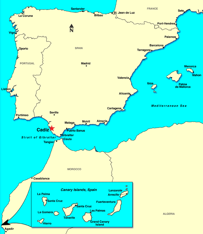
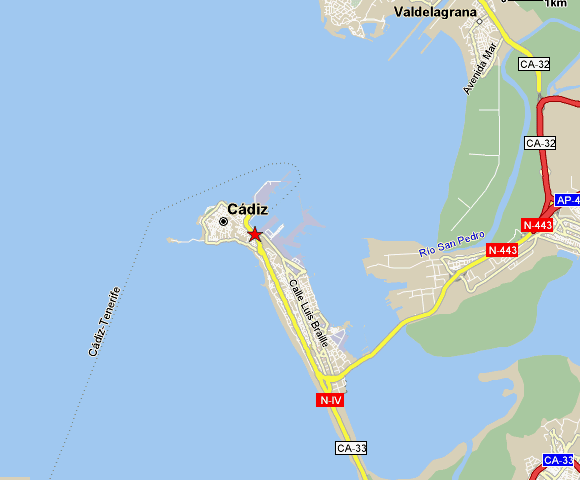
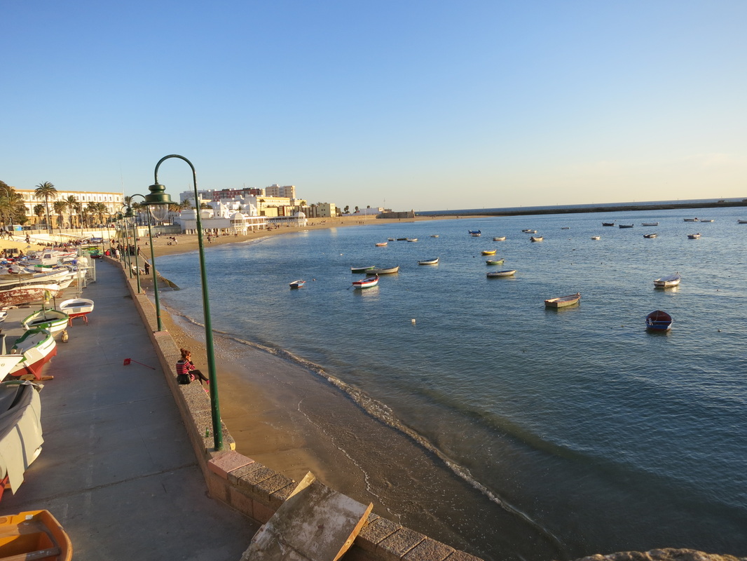
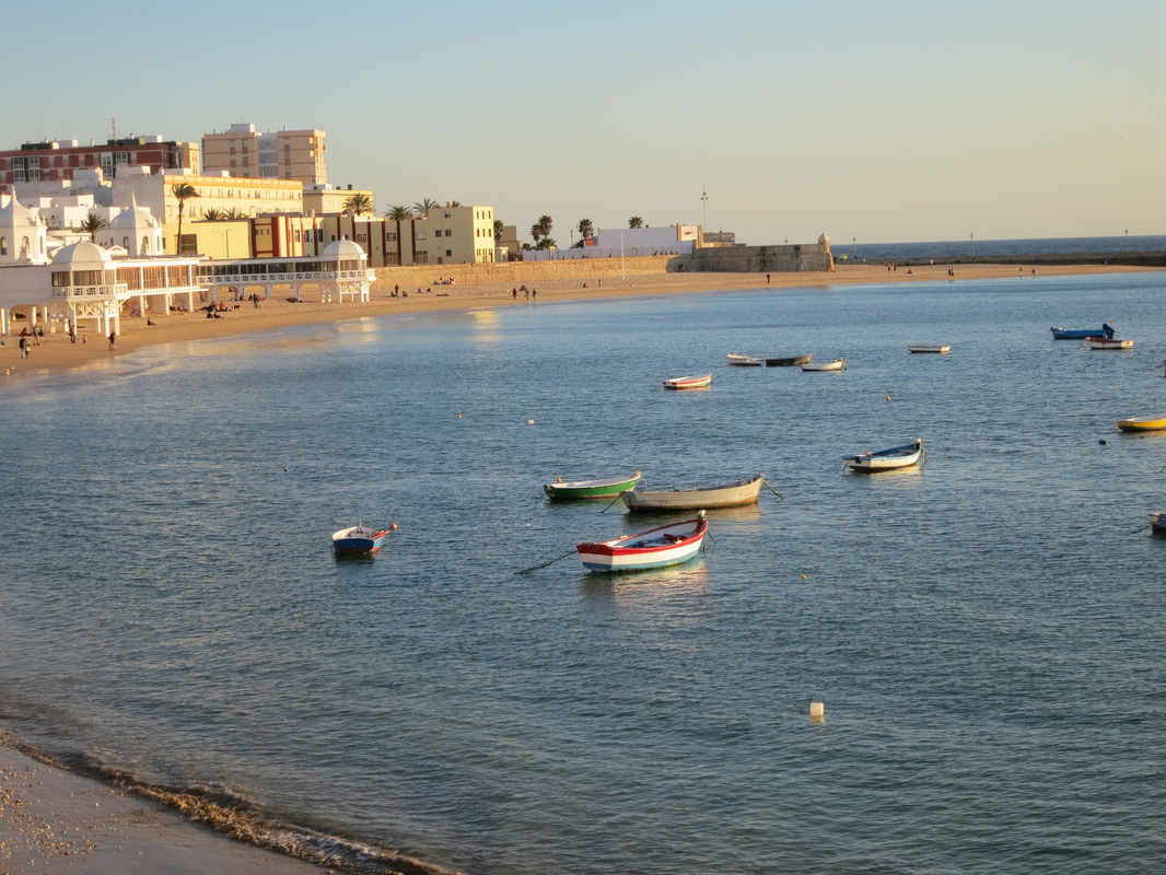
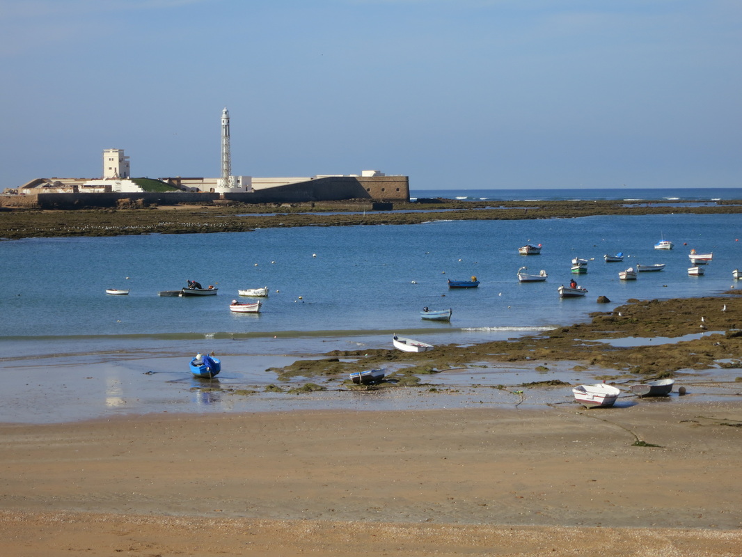
Now take a look at the photos below from the City of Cadíz, Spain. Knowing how to work with the tides is very important if you live in Cadíz as the city is surrounded on three sides by the Ocean! Talk with you team about what you see, and try to answer the questions next to the pictures.
Now take a look at the photos below from the City of Cadíz, Spain. Knowing how to work with the tides is very important if you live in Cadíz as the city is surrounded on three sides by the Ocean! Talk with you team about what you see, and try to answer the questions next to the pictures.

|
Map of Cadíz, Spain. Look at the map. What ocean does Cadíz border?
Evening high tide in Cadíz, Spain. Beautiful fisherman boats along the waters. Early Morning low tides. Notice how the boats are now completely on land! A mere 5 hours ago they were floating on the water! If you were stuck out in your boat without an oar you would be in luck, if you're willing to wait 5 hours that is! ;)
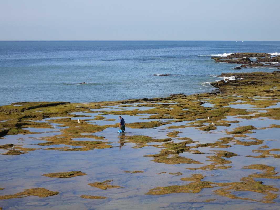
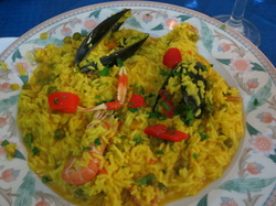
During low tides, fishermen explore the reef and hunt for crustaceans and other sea creatures. They will sell these to the nearbye restaurants that will use them to make Mediterranean sea food dishes.
Paella is the national dish of Spain, and Cadíz is known for their delicious rendition! What types of seafood do you notice in this dish?? Some of these were caught by fisherman during the low tides and made ready by noon! Nothing like eating a fresh dish of paella!
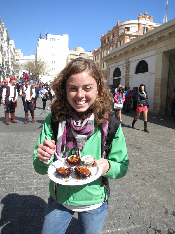
It's always fun to try new things! This is a picture of me eating one of the fisherman's catches. Can you guess what it is? Ask me about this later if you would like to know more...! If you're adventurous you might want to try some too! :)
|
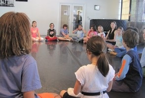
Activity: Act it out!
Now, get together with your team. Together you will act out the tides! Each person will play a role! You will role the dice to see what role you will play, either the part of the moon or part of the earth's oceans.
Now, get together with your team. Together you will act out the tides! Each person will play a role! You will role the dice to see what role you will play, either the part of the moon or part of the earth's oceans.
- Find a place in the room with lot's of space and form a circle.
- Sit down, crossed-legged with hands holding the elbows of the person next to you.
- Number off, 1-4. Roll a dice. If your number is rolled then you will play the part of the moon.
- The Moon: The person who is the moon will move around the outside of the circle. You who are in the circle represent the waters of the earth.
- The Circle: Now, for those in the circle, as the moon passes behind you (water), the waters bulge (lean) toward the moon, and then into the center as the moon passes. Act this out. As the moon moves, those who are opposite the moon lean away from the moon (this represents water bulging out on the opposite side of the earth) and then lean into the center as the moon passes.
- The Moon: Now moon, stop, and everyone see where the high tides are (next to the moon and at the opposite side of the circle). Now, moon, continue to circle. Now, moon, stop at several points in the circle and let everyone see where the high and low tides are in relation to the orbit of the moon. (Low tide will be at the sides halfway between the high tide bulges.)
- The moon should then circle the earth several times so the rhythm of the passing of the moon and the bulging of the waters is experienced by everyone.
- If there is time, switch roles. Roll the dice again and let someone else be the moon.
Activity taken from: http://www.usc.edu/org/seagrant/Education/IELessons/Unit1/Lesson4/U1L4CO.html
